Table of Contents
How Do Mountains Form? Plate Tectonics 101
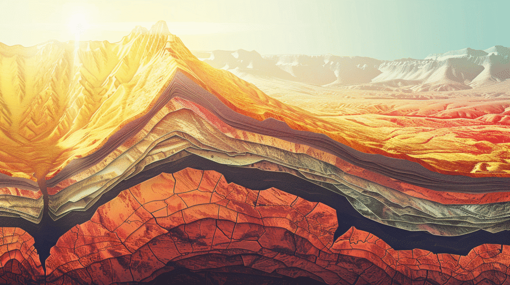
Introduction: The Living Planet Beneath Our Feet
Stand at the base of Mount Everest, gazing upward at the world’s highest peak piercing through clouds at 29,032 feet. The summit towers nearly six miles above sea level—yet remarkably, geologists have found marine fossils near the top, ancient remnants of sea creatures that lived in an ocean hundreds of millions of years ago. How did rocks formed at the bottom of an ancient sea end up at the roof of the world?
Or consider the Andes Mountains, stretching 4,300 miles along South America’s western edge—the longest continental mountain range on Earth. These peaks host hundreds of active volcanoes, experience frequent earthquakes, and continue rising even today. What immense forces could create and sustain such geological violence?
The answer to both questions lies in one of Earth’s most powerful and transformative processes: plate tectonics. This fundamental geological mechanism doesn’t just explain how mountains form—it reveals Earth as a dynamic, ever-changing planet where continents drift across the globe, ocean basins open and close, and massive mountain ranges rise and erode over vast stretches of time.
Mountains represent far more than scenic landscapes or recreational destinations. They profoundly influence climate patterns by blocking weather systems and creating rain shadows. They drive evolution by isolating populations and creating unique ecosystems. They provide freshwater to billions through snowmelt and glaciers. And they tell the story of Earth’s 4.5-billion-year history, preserving evidence of ancient oceans, climates, and life forms in their rocks.
This comprehensive guide explores the fascinating science of mountain formation, from the fundamental mechanisms of plate tectonics to the specific processes that create different types of mountains, examining real-world examples of Earth’s greatest peaks and ranges, understanding the immense timescales involved, and appreciating how these processes continue shaping our planet today.
Understanding Plate Tectonics: Earth’s Moving Surface
Before exploring how mountains form, we must understand the revolutionary theory that explained their origin and transformed our understanding of Earth.
The Structure of Earth’s Interior
Earth is not solid throughout but consists of distinct layers with different physical properties:
Inner Core (1,220 km radius): Solid iron and nickel at approximately 5,400°C. Despite extreme temperatures, immense pressure keeps this core solid.
Outer Core (2,300 km thick): Liquid iron and nickel surrounding the inner core. Convection currents in this layer generate Earth’s magnetic field through the geodynamo effect.
Mantle (2,900 km thick): Comprising about 84% of Earth’s volume, the mantle is solid rock that nonetheless flows slowly over geological time scales through a process called solid-state convection. The mantle is divided into the lower mantle and upper mantle.
Asthenosphere (approximately 80-200 km depth): The upper portion of the mantle where rock is close enough to its melting point to flow plastically. This layer’s mechanical weakness allows the rigid plates above to move.
Lithosphere (0-100 km thick): Earth’s rigid outer shell, consisting of the crust and uppermost mantle. The lithosphere is broken into tectonic plates that float on the asthenosphere.
Crust: The outermost layer, divided into oceanic crust (denser, 5-10 km thick, primarily basaltic rock) and continental crust (less dense, 30-70 km thick, primarily granitic rock).
This layered structure creates the conditions necessary for plate tectonics—a rigid outer shell floating on a weaker, flowing interior.
The Revolutionary Theory of Plate Tectonics
The theory of plate tectonics emerged in the 1960s, synthesizing decades of observations into a unified explanation of Earth’s geological activity:
Continental Drift (early 1900s): Alfred Wegener proposed that continents had once been joined in a supercontinent called Pangaea and subsequently drifted apart. Though initially dismissed, evidence accumulated supporting this idea.
Seafloor Spreading (1960s): Discovery that new oceanic crust forms at mid-ocean ridges and spreads outward provided a mechanism for continental drift.
Plate Tectonics Theory (late 1960s): Integration of these concepts revealed that Earth’s lithosphere consists of rigid plates moving atop the asthenosphere, driven by mantle convection.
This theory revolutionized geology, explaining not just mountain formation but also earthquakes, volcanoes, the distribution of fossils and rock types, and the configuration of continents and ocean basins.
Tectonic Plates: Earth’s Moving Puzzle Pieces
The lithosphere is divided into seven major plates and numerous smaller ones:
Major Plates:
- Pacific Plate (largest, primarily oceanic)
- North American Plate
- Eurasian Plate
- African Plate
- Antarctic Plate
- Indo-Australian Plate
- South American Plate
Notable Smaller Plates:
- Caribbean Plate
- Arabian Plate
- Nazca Plate
- Philippine Sea Plate
- Cocos Plate
- Juan de Fuca Plate
These plates range from thousands to tens of thousands of kilometers across and include both oceanic and continental crust, or combinations of both.
What Drives Plate Motion?
Tectonic plates move at rates of 1-10 centimeters per year—roughly the rate fingernails grow—driven by several mechanisms:
Mantle Convection: Heat from Earth’s core and radioactive decay in the mantle creates convection currents. Hot mantle material rises, cools near the surface, then sinks again, driving circulation that drags plates along.
Ridge Push: At mid-ocean ridges where new crust forms, the elevated topography creates a gravitational force pushing plates away from the ridge.
Slab Pull: Where oceanic plates subduct into the mantle, the cold, dense sinking slab pulls the rest of the plate behind it. This is likely the strongest force driving plate motion.
Mantle Plumes: Rising columns of abnormally hot mantle material (hotspots) create volcanic activity and may influence plate motion, though their role remains debated.
These forces combine to keep Earth’s tectonic plates in constant motion, creating the conditions for mountain building.
Plate Boundaries: Where Mountains Are Born
Mountains form primarily at plate boundaries—the zones where tectonic plates interact. Understanding these boundary types is essential to understanding mountain formation.
Convergent Boundaries: Where Plates Collide
Convergent boundaries occur where plates move toward each other, creating immense compressional forces that build the world’s highest and most dramatic mountain ranges. The specific type of mountain formation depends on what types of crust collide.
Continental-Continental Collision: The Highest Mountains
When two continental plates collide, neither can subduct because continental crust is too light and buoyant to sink into the denser mantle. Instead, the crust thickens dramatically through folding, faulting, and uplift, creating the world’s highest mountain ranges.
The Process:
- Approach: Two continental plates drift toward each other, often with an ocean basin between them
- Ocean Closure: Oceanic crust between the continents subducts, gradually closing the ocean
- Continental Collision: When the ocean closes completely, continental margins collide
- Crustal Thickening: Unable to subduct, continental crust folds, faults, and stacks on itself
- Uplift: The thickened crust rises isostatically (like a floating iceberg rising when weight is added)
- Continued Collision: Mountain building continues as long as plates converge
The Himalayas: Earth’s Greatest Mountain Range
The Himalayas provide the premier example of continental collision mountains:
Formation History: About 50 million years ago, the Indian Plate (originally part of the ancient supercontinent Gondwana) collided with the Eurasian Plate after the Tethys Ocean between them closed. The collision continues today—India moves northward at about 5 cm/year, driving the Himalayas higher.
Scale: The Himalayas extend about 2,400 km across northern India, Pakistan, Bhutan, and Nepal, with widths exceeding 350 km. The range contains all 14 peaks over 8,000 meters (26,247 feet), including Mount Everest.
Crustal Thickness: The collision has created crust up to 70 km thick—more than twice normal continental thickness. This thickened crust creates the extreme elevations.
Ongoing Rise: The Himalayas continue rising at approximately 5 mm per year, though erosion partially offsets this uplift.
Secondary Effects: The collision has created the Tibetan Plateau—the highest and largest plateau on Earth at average elevations exceeding 4,500 meters (14,800 feet), often called “the roof of the world.”
Other Examples:
- Alps: Collision between African and Eurasian plates, creating Switzerland’s dramatic peaks
- Zagros Mountains: Collision between Arabian and Eurasian plates in Iran and Iraq
- Appalachians: Ancient mountains formed 480-300 million years ago when proto-North America collided with proto-Africa and proto-Europe during Pangaea assembly
Oceanic-Continental Collision: Volcanic Mountain Chains
When an oceanic plate collides with a continental plate, the denser oceanic crust subducts (sinks) beneath the lighter continental crust, creating a subduction zone. This process builds volcanic mountain ranges along continental edges.
The Process:
- Subduction: Oceanic plate descends into the mantle at an angle (typically 30-60°)
- Melting: As the plate descends, increasing temperature and pressure cause water-rich minerals to release water
- Magma Generation: Water lowers the melting point of mantle rock above the subducting slab, causing partial melting
- Magma Rise: The buoyant magma rises through the continental crust
- Volcanic Eruptions: Magma erupts at the surface, building volcanic mountains
- Crustal Deformation: Compression at the plate boundary also causes folding and faulting, adding to mountain building
The Andes: The World’s Longest Continental Mountain Range
The Andes exemplify oceanic-continental collision mountains:
Formation: The Nazca Plate (oceanic) subducts beneath the South American Plate (continental), creating a subduction zone along South America’s western coast. This process began about 200 million years ago but accelerated 25 million years ago.
Extent: Stretching 7,000 km from Venezuela to Chile and Argentina—the longest continental mountain range on Earth.
Volcanism: The Andes host over 200 volcanoes, including many active ones. The volcanic chain reflects the subduction zone location.
Earthquakes: The subduction zone generates frequent and sometimes devastating earthquakes, including the 1960 Valdivia earthquake—the most powerful ever recorded at magnitude 9.5.
Height: Despite being volcanic rather than purely collision mountains, several Andean peaks exceed 6,000 meters (19,685 feet), with Aconcagua reaching 6,961 meters (22,838 feet)—the highest peak outside Asia.
Other Examples:
- Cascade Range: Juan de Fuca Plate subducting beneath North American Plate, creating volcanoes like Mount Rainier, Mount St. Helens, and Mount Hood
- Aleutian Range: Pacific Plate subducting beneath North American Plate in Alaska
- Japanese Alps: Pacific and Philippine Sea plates subducting beneath Eurasian Plate
Oceanic-Oceanic Collision: Island Arcs
When two oceanic plates collide, the older, denser plate typically subducts beneath the younger one, creating volcanic island arcs—chains of volcanic islands parallel to the subduction zone.
Examples:
- Mariana Islands: Including the Mariana Trench—Earth’s deepest point
- Aleutian Islands: Volcanic arc in Alaska
- Caribbean Islands: Lesser Antilles volcanic arc
- Japanese Islands: Formed by multiple subduction zones
While these create mountains rising from the seafloor, they’re typically not classified with continental mountain ranges.
Divergent Boundaries: Mountains Born from Rifting
Divergent boundaries occur where plates move apart, allowing mantle material to rise, partially melt, and form new crust. While perhaps counterintuitive, this process creates mountains—primarily underwater but sometimes on land.
Mid-Ocean Ridges: Earth’s Longest Mountain Chain
Mid-ocean ridges form where oceanic plates diverge:
The Process:
- Plates separate, creating a gap in the lithosphere
- Underlying asthenosphere rises to fill the gap
- Reduced pressure causes partial melting, generating basaltic magma
- Magma erupts along the ridge axis, creating new oceanic crust
- New crust cools and solidifies, then spreads away from the ridge
- Continuous volcanic activity builds an underwater mountain range
The Mid-Atlantic Ridge: Hidden Mountain Giants
The Mid-Atlantic Ridge provides the classic example:
Extent: Running 16,000 km down the center of the Atlantic Ocean from the Arctic to near Antarctica—the longest mountain range on Earth.
Height: Rising 2,000-3,000 meters above the surrounding ocean floor, with some peaks breaking the surface as volcanic islands (Iceland, Azores, Ascension Island).
Iceland: The rare place where a mid-ocean ridge rises above sea level, allowing direct observation of rifting processes. Iceland is literally being pulled apart, widening by about 2 cm per year.
Seafloor Spreading: As new crust forms at the ridge, it pushes older crust away, creating symmetric magnetic patterns that provided crucial evidence for plate tectonics.
Other Examples:
- East Pacific Rise: Fastest spreading rate (over 15 cm/year)
- Southwest Indian Ridge: Slowest spreading rate (about 1.5 cm/year)
Continental Rifts: Mountains from Pulling Apart
When continents begin to rift apart, the process creates distinctive mountain features:
Rift Valley Formation:
- Tensional forces stretch continental crust
- The crust thins and eventually breaks along normal faults
- A central block drops down, creating a rift valley
- Blocks on either side remain elevated, forming parallel mountain ranges
- Volcanic activity often accompanies rifting as magma rises through the thinned crust
East African Rift System: A Continent Splitting
The East African Rift demonstrates active continental rifting:
Extent: Stretching 3,000 km from the Red Sea through eastern Africa Process: Africa is literally splitting apart—the Somali Plate is separating from the Nubian Plate Features: The rift valley is flanked by uplifted highlands and volcanic mountains Volcanoes: Includes Mount Kilimanjaro (5,895 m) and Mount Kenya (5,199 m) Future: In millions of years, the rift may become a new ocean basin, separating East Africa from the rest of the continent
Other Examples:
- Basin and Range Province: Southwestern United States, where continental crust has been stretched and broken
- Rio Grande Rift: Creating the mountains surrounding the Rio Grande valley in New Mexico
Transform Boundaries: Minimal Mountain Building
Transform boundaries occur where plates slide horizontally past each other, creating fault zones rather than mountains. However, local compression and uplift along these faults can create modest mountain features.
San Andreas Fault: The Pacific Plate slides northwestward past the North American Plate at about 5 cm/year. While the San Andreas Fault itself doesn’t build major mountains, nearby fault systems and crustal deformation have contributed to mountain building in California.
Transverse Ranges: Southern California ranges like the San Gabriel Mountains have been uplifted by compression where the San Andreas Fault bends, creating localized convergence.
Other Mountain-Building Processes
Beyond plate boundaries, several other mechanisms create mountains:
Fault-Block Mountains: Breaking and Tilting
Fault-block mountains form when large blocks of crust break along faults and move vertically relative to each other, often in response to extensional (stretching) forces.
Formation Process:
- Tensional stress stretches the crust
- The crust fractures along normal faults
- Some blocks drop down (grabens), forming valleys
- Other blocks remain elevated or tilt upward (horsts), forming mountain ranges
- Fault scarps (steep cliffs) mark the fault lines
Sierra Nevada: A Tilted Block
The Sierra Nevada in California exemplifies fault-block mountains:
Formation: A massive block of granite tilted upward along faults on its eastern side, creating the dramatic eastern escarpment while the western slope remains gentle.
Scale: About 650 km long and 100 km wide, with peaks exceeding 4,000 meters (13,000 feet), including Mount Whitney at 4,421 meters (14,505 feet)—the highest peak in the contiguous United States.
Age: Began forming about 20 million years ago, with increased uplift in the last 10 million years.
Other Examples:
- Grand Tetons: Tilted fault block in Wyoming with dramatic eastern face
- Wasatch Range: Utah’s fault-block range with prominent fault scarps
- Vosges and Black Forest: Mirror-image fault blocks on opposite sides of the Rhine Graben in Europe
Volcanic Mountains: Built by Fire
Volcanic mountains form through accumulation of erupted material rather than tectonic collision or uplift. While many volcanoes occur at convergent plate boundaries (already discussed), others form through different mechanisms.
Hotspot Volcanoes
Hotspots are stationary plumes of abnormally hot mantle that generate volcanism independent of plate boundaries:
Hawaiian Islands: Conveyor Belt Volcanism
The Hawaiian Island chain demonstrates hotspot volcanism:
Formation: A mantle plume creates a hotspot beneath the Pacific Plate. As the plate moves northwest over the stationary hotspot, volcanoes form, then become extinct as they’re carried away from the heat source. A new volcano forms over the hotspot, creating a chain of progressively older volcanic mountains.
Current Activity: The Big Island of Hawaii sits over the hotspot and remains volcanically active, with Mauna Loa and Kilauea among Earth’s most active volcanoes.
Scale: Mauna Kea, measured from its base on the ocean floor, stands 10,203 meters (33,476 feet) tall—taller than Mount Everest from sea level, though only 4,207 meters (13,803 feet) rises above sea level.
Other Hotspot Examples:
- Yellowstone: Continental hotspot creating volcanic features in Wyoming
- Iceland: Hotspot coinciding with the Mid-Atlantic Ridge
- Galapagos Islands: Hotspot in the eastern Pacific
Shield Volcanoes vs. Stratovolcanoes
Volcanic mountains take different forms depending on eruption style:
Shield Volcanoes: Broad, gently sloping mountains built by fluid basaltic lava flows. Hawaiian volcanoes exemplify this type.
Stratovolcanoes (Composite Volcanoes): Steep, cone-shaped mountains built by alternating layers of lava flows, ash, and volcanic debris. More explosive eruptions create these dramatic peaks. Examples include Mount Fuji, Mount Rainier, and Mount Vesuvius.
Dome Mountains: Uplifted Without Eruption
Dome mountains form when magma intrudes beneath the surface but doesn’t erupt, pushing overlying rock layers upward into a dome shape. Erosion later removes softer sedimentary rocks, exposing the harder igneous core.
Black Hills: South Dakota’s Black Hills formed through dome uplift, with crystalline rocks exposed in the center surrounded by sedimentary layers dipping away.
Other Examples:
- Adirondack Mountains: New York dome mountains
- Ozark Mountains: Missouri and Arkansas erosional dome
The Timeline of Mountain Building: Patience Measured in Millions
Mountain formation operates on timescales difficult for humans to comprehend. Understanding these vast periods helps appreciate the gradual but inexorable power of plate tectonics.
Orogeny: The Mountain-Building Process
Orogeny refers to episodes of mountain building, typically lasting tens of millions of years:
Collision Phase: When plates initially collide, maximum compression and uplift occur. This phase might last 10-50 million years.
Continued Convergence: As long as plate motion continues, mountains keep rising, though rates may decrease as resistance increases.
Erosional Equilibrium: Eventually, erosion balances uplift, with mountains neither rising nor falling significantly.
Post-Orogenic Evolution: When plate convergence ceases, erosion dominates, gradually wearing mountains down.
Examples of Mountain-Building Timescales
Himalayas: The India-Asia collision began about 50 million years ago and continues today. The most rapid uplift occurred 25-15 million years ago.
Andes: Andean mountain building has occurred in multiple phases over 200 million years, with the modern Andes largely forming in the last 25 million years.
Appalachians: These ancient mountains formed during multiple orogenies 480-300 million years ago when North America collided with Africa and Europe during Pangaea assembly. Once as high as the Himalayas, erosion has reduced them to modest elevations over hundreds of millions of years.
Alps: The Africa-Europe collision creating the Alps began about 65 million years ago, with the main mountain-building phase occurring 35-15 million years ago.
Rates of Uplift and Erosion
Typical Uplift Rates: Most mountain ranges rise at 1-10 mm per year. The Himalayas’ approximately 5 mm/year represents a fast rate.
Erosion Rates: Depend heavily on climate, rock type, and elevation. Rates of 0.1-2 mm per year are common, meaning erosion can keep pace with or exceed uplift.
Isostatic Balance: As erosion removes weight, mountains rise isostatically (like a floating object rising when load is removed), prolonging their elevation.
Net Result: Whether mountains grow or shrink depends on the balance between tectonic uplift and erosion. Active mountain ranges generally show net growth, while tectonically inactive ranges gradually erode away.
The Cycle Continues: Mountains Rise and Fall
Mountain building represents one phase in the rock cycle—the continuous transformation of rocks through geological processes.
From Mountains to Sediment
Weathering: Physical (freeze-thaw, thermal expansion) and chemical (dissolution, oxidation) processes break down rock at Earth’s surface.
Erosion: Water, wind, ice, and gravity transport weathered material downslope and downstream.
Deposition: Eroded sediment accumulates in basins—river deltas, lake bottoms, ocean floors—forming sedimentary layers.
Lithification: Over time, pressure and chemical cementing convert loose sediment to sedimentary rock.
From Sediment to Mountains Again
Subduction: Sediments on oceanic crust may be scraped off and accreted to continents during subduction.
Collision: When continents collide, sedimentary rocks deposited in intervening ocean basins are compressed, folded, and incorporated into new mountains.
Metamorphism: Intense pressure and temperature during mountain building transform sedimentary rocks into metamorphic rocks.
Melting: At great depth, rocks may melt, eventually cooling to form igneous rocks completing the cycle.
The Supercontinent Cycle
On even larger scales, continents periodically assemble into supercontinents, then break apart:
Assembly: Continents converge, closing ocean basins and building mountain ranges.
Pangaea: The most recent supercontinent existed about 300-200 million years ago.
Breakup: Rifting splits supercontinents apart, creating new ocean basins.
Dispersal: Continents drift to maximum separation.
Reassembly: Continents begin converging again toward a new supercontinent.
This cycle takes about 500-700 million years to complete. Mountains form during both assembly (collision mountains) and breakup (rift-related uplift).
Why Mountain Building Matters: Beyond Scenic Beauty
Mountains profoundly influence Earth systems and human civilization:
Climate and Weather
Orographic Precipitation: Mountains force air upward, causing cooling and precipitation on windward slopes while creating rain shadows on leeward sides. The Andes create the Atacama Desert—Earth’s driest place.
Global Climate: Major mountain ranges influence atmospheric circulation patterns and monsoon systems. The Himalayas drive the Asian monsoon affecting billions of people.
Glaciers and Snowpack: Mountain glaciers and seasonal snowpack provide freshwater to billions downstream.
Ecosystems and Biodiversity
Habitat Diversity: Elevation gradients create multiple climate zones within short distances, supporting diverse ecosystems.
Isolation and Speciation: Mountains isolate populations, driving evolutionary divergence and creating biodiversity hotspots.
Endemic Species: Many mountain ranges host unique species found nowhere else.
Resources
Minerals: Mountain building concentrates valuable minerals through metamorphism, hydrothermal activity, and plutonism. Many major mineral deposits occur in mountain belts.
Water: Mountains capture and store precipitation, feeding rivers that supply water to lowlands.
Forests: Mountain forests provide timber and regulate water flow.
Human Impact
Population: While rugged, mountains host about 12% of the global human population and influence water supply for about half of humanity.
Cultural Diversity: Geographic isolation in mountains has preserved linguistic and cultural diversity.
Recreation and Tourism: Mountains attract millions of visitors for recreation and tourism, driving significant economic activity.
Hazards: Mountains also pose hazards—landslides, avalanches, glacial lake outburst floods, and volcanic eruptions affect mountain communities.
Conclusion: Dynamic Earth, Eternal Mountains
Mountains represent Earth’s most dramatic and enduring features, yet they’re products of ceaseless change driven by plate tectonics—the slow but inexorable motion of our planet’s surface. Every mountain range tells a story: of continents that drifted across the globe, collided with tremendous force, and thrust ancient seafloors skyward; of volcanic chains marking where oceanic crust plunges into the mantle; of rifts where continents begin to tear apart; of hotspots where mantle plumes punch through moving plates.
The Himalayas reveal a collision still in progress, with India continuing its northward march into Asia at 5 centimeters per year—imperceptible to human perception but powerful enough to raise Earth’s highest peaks. The Andes document 200 million years of subduction, with their active volcanoes reminding us that mountain building isn’t ancient history but an ongoing process. The ancient Appalachians, once rivaling the Himalayas in height, show the ultimate fate of all mountains—erosion gradually wearing them down, though taking hundreds of millions of years to do so.
Understanding how mountains form through plate tectonics reveals Earth as a dynamic, living planet where the solid ground beneath our feet is anything but static. Continents drift, ocean basins open and close, and mountains rise and erode in an endless cycle spanning billions of years. This perspective transforms how we view not just mountains but Earth itself—not as a static backdrop for life but as an active participant shaping the conditions that make life possible.
Plate tectonics drives more than just mountain building. It recycles crustal material, bringing fresh nutrients to the surface while burying organic carbon. It drives the carbon cycle that regulates Earth’s climate over geological time. It creates the diverse environments that foster biodiversity. It generates the volcanic activity that outgassed the atmosphere and oceans. Without plate tectonics, Earth would likely be a lifeless, water-covered world with minimal topographic relief—much like Venus, a similar-sized planet that apparently lacks plate tectonics.
The next time you gaze at a mountain range—whether the soaring peaks of the Rockies, the volcanic cones of the Cascades, the ancient rounded summits of the Appalachians, or the distant snow-capped Himalayas—remember you’re witnessing the slow, powerful art of plate tectonics. These mountains are monuments to Earth’s dynamic nature, records of a planet in constant motion, and reminders that even features that seem eternal on human timescales are temporary on geological timescales.
And the process continues. Mountains are rising even now—the Himalayas perhaps 5 millimeters this year, the Andes similar amounts. Volcanoes erupt, building new mountains even as erosion wears down old ones. Continents continue their slow drift toward an eventual new supercontinent hundreds of millions of years hence. The story of mountain building isn’t finished—it’s a story without end, as long as Earth’s interior remains hot enough to drive plate tectonics, as long as our planet remains geologically alive.
Additional Resources
For those seeking deeper understanding of plate tectonics and mountain formation, the United States Geological Survey provides comprehensive educational resources on plate tectonics, earthquake hazards, and volcanic activity.
The Smithsonian Institution’s Global Volcanism Program offers detailed information on volcanic mountains worldwide, including eruption histories, current activity, and the geological processes behind volcanic mountain building.