Table of Contents
How the Nile Shaped Ancient Egypt: The River That Built a Civilization
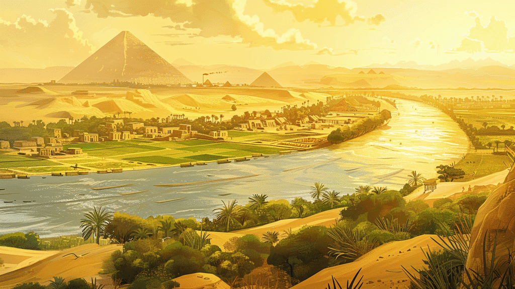
The story of Ancient Egypt is inseparable from the story of the Nile River—the lifeline that made one of the world’s greatest civilizations possible. Stretching over 4,100 miles through northeastern Africa, the Nile transformed what would otherwise be uninhabitable desert into a fertile cradle of life, culture, and unprecedented human achievement. It was far more than a source of water; it was the foundation of Egypt’s agriculture, economy, transportation network, religious worldview, political structure, and cultural identity.
Without the Nile, there would be no pyramids piercing the desert sky, no pharaohs commanding vast kingdoms, no hieroglyphic wisdom preserved on papyrus, and no Egyptian civilization as we know it. The river didn’t just enable Egyptian civilization—it fundamentally shaped every aspect of how ancient Egyptians lived, thought, and understood their place in the cosmos.
Understanding how the Nile influenced Ancient Egypt reveals profound insights about the relationship between geography and civilization, demonstrating how a single geographic feature can determine the trajectory of human development for thousands of years.
The Geography of the Nile: A River Flowing Backward Through Desert
The Nile River follows a unique geographic path, flowing northward through northeastern Africa before emptying into the Mediterranean Sea—a direction that ancient peoples considered “backward” since most major rivers in their experience flowed southward. This north-flowing characteristic would prove crucial to Egyptian civilization.
The River’s Two Tributaries: Different Sources, United Purpose
The Nile draws from two major tributaries, each with distinct geographic origins and characteristics:
The White Nile: Originating in the Great Lakes region of central Africa (particularly Lake Victoria), the White Nile provides a relatively steady, consistent flow throughout the year. Its waters travel through Uganda, South Sudan, and Sudan, covering over 2,000 miles before joining its sister river.
The Blue Nile: Beginning in Lake Tana in the Ethiopian Highlands, the Blue Nile contributes the majority of the water volume and virtually all of the sediment that historically made Egyptian agriculture possible. The Ethiopian monsoon rains, arriving between June and September, cause dramatic seasonal variation in the Blue Nile’s flow.
These two rivers converge near modern-day Khartoum, Sudan, then continue as a single unified river through the harsh desert landscape of Sudan and Egypt for another 1,800 miles to the Mediterranean.
The Black Land and the Red Land: A Study in Contrasts
This unique geography created one of Earth’s most striking environmental contrasts: a narrow ribbon of lush green fertility winding through otherwise barren desert. In some places, the transition from verdant farmland to lifeless desert occurred within a few dozen feet—you could literally stand with one foot in each world.
The ancient Egyptians recognized and named these two landscapes:
“Kemet” (The Black Land): The dark, nutrient-rich soil deposited by the Nile’s annual floods, representing life, fertility, and civilization. This was Egypt proper—where people lived, farmed, and built their society.
“Deshret” (The Red Land): The reddish-orange desert surrounding the Nile valley, representing chaos, death, and the dangerous unknown. Yet this desert also provided protection—geographic barriers that shielded Egypt from invasion and allowed its civilization to develop with remarkable stability.
This geographic dichotomy profoundly influenced Egyptian worldview and philosophy—they saw their world as an island of order (ma’at) surrounded by chaos, a cosmic balance that the gods and pharaohs must maintain.
The Nile Valley: Dimensions of a Civilization
The habitable Nile valley—the strip of fertile land on either side of the river—was remarkably narrow:
- Width: Typically just 6-13 miles wide, though expanding in some areas
- Length: Approximately 600 miles of continuously habitable territory from the First Cataract (Aswan) to the Mediterranean
- Total area: Roughly 10,000 square miles of arable land—only about 3% of Egypt’s total territory
This geographic concentration meant that virtually the entire Egyptian population lived within sight of the Nile. The river wasn’t just important—it was omnipresent in daily life, visible from nearly everywhere people lived.
The valley’s narrowness also created a linear civilization, with most settlements stretched along the river’s length rather than spreading across broad territories. This geographic pattern facilitated political unification and cultural cohesion in ways that broader, more dispersed territories could not.
The Cataracts: Natural Boundaries
Six areas of rapids and rocky outcrops, called cataracts, interrupted the Nile’s flow through Sudan and southern Egypt. These cataracts created natural boundaries:
The First Cataract at Aswan marked Egypt’s traditional southern border, separating it from Nubia. The difficult navigation here created a geographic barrier that defined Egyptian territory while also serving as a strategic defensive position.
The other five cataracts, located further south in Sudan, created obstacles to navigation but also opportunities—they concentrated trade at portage points where goods had to be transferred overland around the rapids.
The Gift of the Nile: Annual Flooding and Agricultural Abundance
The Nile’s most transformative characteristic was its predictable annual flood cycle—a natural phenomenon that turned what should have been desert into some of the most productive farmland in the ancient world.
The Mechanics of the Flood: A Hydrological Miracle
Each year, between June and September, the Nile flooded its banks in a cycle so reliable that ancient Egyptians organized their entire calendar around it. This flooding resulted from:
Ethiopian Monsoons: Heavy summer rains in the Ethiopian Highlands swelled the Blue Nile, which contributed approximately 80% of the Nile’s water during flood season despite providing only about 20% during the rest of the year.
Timing: The floods began arriving in Egypt in June, peaked in September, and receded by October—leaving behind saturated soil perfect for planting winter crops.
Sediment Deposition: The floodwaters carried rich, dark silt eroded from volcanic highlands in Ethiopia. When waters receded, this sediment remained, replenishing soil nutrients naturally without need for fertilizers.
The Greek historian Herodotus (5th century BCE) famously called Egypt the “Gift of the Nile,” recognizing that this flooding created Egypt’s prosperity. He wrote: “Egypt is the gift of the river,” understanding that without the Nile’s annual inundation, Egypt would be merely an extension of the Libyan and Arabian deserts.
Agricultural Abundance: The Foundation of Civilization
The Nile’s floods provided multiple agricultural advantages:
Natural Fertilization: The deposited silt contained nutrients that maintained soil fertility year after year for thousands of years, preventing the soil exhaustion that plagued other ancient civilizations.
Predictable Water Supply: Unlike rain-dependent agriculture (which requires hoping for precipitation at the right times), the Nile’s flooding was remarkably consistent, arriving at roughly the same time each year with similar intensity.
Moisture Retention: After floods receded, the saturated soil retained moisture for months, supporting crop growth through the dry season.
Multiple Harvests: The reliable water supply sometimes enabled two harvests per year in particularly favorable locations.
This agricultural productivity supported the cultivation of:
- Wheat and barley: Staple grains that provided the caloric foundation of Egyptian diet
- Flax: Used to produce linen, Egypt’s primary textile
- Papyrus: The writing material that gave us the root word for “paper”
- Vegetables: Onions, garlic, leeks, lettuce, cucumbers, and others
- Fruits: Dates, figs, grapes, melons
- Legumes: Lentils, chickpeas, beans
The Egyptian Calendar: Organizing Life Around the River
The Nile’s predictability was so fundamental that Egyptians organized their entire calendar around its cycle, dividing the year into three seasons:
Akhet (Inundation): June-September, when floods covered the land. During this period, farmers couldn’t work fields but were often conscripted for monumental construction projects (pyramid building occurred primarily during inundation season).
Peret (Emergence): October-February, when waters receded and farmers planted crops in the moist, fertile soil. This was the primary agricultural season.
Shemu (Harvest): March-May, when crops matured and were harvested before the cycle began again.
This three-season calendar, used for over 3,000 years, demonstrates how completely the Nile’s rhythm governed Egyptian life. The river didn’t just feed Egypt—it structured time itself.
Agricultural Surplus: The Engine of Civilization
The Nile’s reliability generated agricultural surpluses far beyond immediate subsistence needs. This surplus made possible:
Population Growth: Egypt sustained population densities far exceeding what the desert climate would otherwise support—possibly 3-4 million people at the height of ancient Egyptian power.
Specialization: Surplus food freed people to become craftsmen, priests, scribes, soldiers, and administrators rather than farmers, enabling complex social organization.
Trade: Grain became a valuable export commodity, traded for lumber (from Lebanon), metals, and luxury goods Egypt lacked.
Taxation: Pharaohs collected taxes primarily in grain, which could be stored in granaries and redistributed to support government, military, and monumental construction.
Monumental Architecture: The ability to feed large workforces enabled the construction of pyramids, temples, and tombs that required thousands of laborers for years or decades.
In essence, the Nile’s floods created the economic foundation that elevated Egypt from subsistence farming to one of history’s most sophisticated civilizations.
Settlements and Civilization Along the Nile: The River as Highway
The Nile wasn’t just a source of food and water—it was Egypt’s primary transportation network, a natural highway that fostered trade, communication, military movement, and political unity.
The Geographic Advantage of Bidirectional Travel
The Nile possessed a unique characteristic that made it exceptional as a transportation route: bidirectional ease of travel.
Northward Current: The river’s natural flow carried boats downstream (north) toward the Mediterranean without requiring rowing or sail.
Southward Wind: Prevailing winds blow from north to south (from the Mediterranean inland), allowing sailboats to easily travel upstream against the current.
This meant that boats could travel both directions with minimal effort—simply drift with current going north or raise sails going south. This geographic gift made the Nile an extraordinarily efficient transportation network that connected all of Egypt.
Contrast this with rivers like the Mesopotamian Tigris and Euphrates, which flow south-southeast but don’t benefit from opposing winds, making upstream travel difficult and limiting their effectiveness as transportation networks.
Political Unification: Geography Enables Empire
The Nile’s role as connector made political unification not just possible but almost inevitable:
Upper and Lower Egypt: Egyptians divided their country into Upper Egypt (the southern Nile valley, called “upper” because the Nile flows from south to north) and Lower Egypt (the northern delta region). Around 3100 BCE, King Narmer (also called Menes) unified these regions, creating one of the world’s first centralized states.
The Double Crown: Pharaohs wore the “pschent,” combining the white crown of Upper Egypt and the red crown of Lower Egypt, symbolizing unified rule over the entire river valley.
Natural Unity: Unlike Mesopotamia, where multiple independent city-states competed for centuries, Egypt’s linear geography along a single river encouraged unification. The Nile provided both the means (transportation for armies and administration) and the incentive (controlling the entire river system maximized economic and strategic advantages).
Administrative Efficiency: The river enabled rapid communication and movement of officials, soldiers, and goods throughout the kingdom. Pharaonic administration could actually govern distant territories because the Nile made them accessible.
This geographic unification created remarkable political stability—Egypt maintained continuous civilization for over 3,000 years, far exceeding most other ancient states.
Cities and Trade: Nodes Along the River
Major Egyptian cities developed along the Nile, each serving specific economic or political functions:
Memphis: Located near the junction of Upper and Lower Egypt (just south of modern Cairo), Memphis served as capital for much of the Old Kingdom. Its strategic position allowed control over both regions and access to delta resources.
Thebes (modern Luxor): Southern capital during the Middle and New Kingdoms, Thebes became Egypt’s religious center. The Karnak and Luxor temple complexes demonstrate the city’s importance.
Alexandria: Founded by Alexander the Great in 331 BCE at the Mediterranean coast, Alexandria became the Hellenistic and Roman period capital and one of the ancient world’s greatest cities, housing the famous Library of Alexandria.
Trade Network: The river connected Egypt internally while also linking to:
- Nubia (to the south): Source of gold, ivory, ebony, and incense
- Mediterranean world (to the north): Trade with Greece, Phoenicia, and later Rome
- Red Sea (via canal systems): Access to Punt (probably Somalia/Yemen) for myrrh, frankincense, and exotic goods
The Nile transformed what could have been isolated settlements into an integrated economic and political system, demonstrating how a single geographic feature can shape the entire structure of civilization.
The Nile’s Role in Religion and Mythology: Sacred Waters
To ancient Egyptians, the Nile was far more than a physical river—it was a divine force, a manifestation of cosmic order, and a bridge between the earthly and spiritual realms. The river’s life-giving properties made it central to Egyptian religion and mythology.
Hapi: The God of Inundation
Hapi was the deity personifying the annual flood, representing abundance and fertility:
Iconography: Depicted as a well-fed man with a large belly and breasts, symbolizing nourishing abundance. Sometimes shown in blue (representing water) or green (representing fertility), often carrying offerings of food and water.
Androgynous Nature: Hapi’s combined masculine and feminine characteristics symbolized the river’s role as both father (providing) and mother (nurturing) to Egypt.
Cult and Worship: Egyptians performed rituals and festivals honoring Hapi at the beginning of the inundation season, beseeching him for a “good Nile”—neither too high (causing destructive flooding) nor too low (causing famine).
“Hymn to Hapi”: Ancient texts praise the deity: “Hail to you, Hapi, sprung from earth, come to nourish Egypt… When you flood, the land exults, every belly rejoices, every jawbone takes on laughter, and every tooth is bared in a smile.”
Osiris: Death, Rebirth, and the River’s Cycle
Osiris, god of the afterlife and resurrection, became intimately associated with the Nile’s annual cycle:
Mythological Connection: According to Egyptian mythology, Osiris was murdered by his brother Set, dismembered, and scattered. His wife Isis reassembled him, enabling his resurrection. This death and rebirth mirrored the agricultural cycle enabled by the Nile—the land appearing dead during dry seasons, then resurrected by the flood.
The Nile as Osiris’s Blood: Some traditions held that the Nile’s floodwaters represented Osiris’s lifeblood or tears of Isis, connecting the river’s life-giving properties to divine resurrection.
Fertility and Renewal: Osiris represented not just death but regeneration—his green skin in iconography symbolized vegetation and renewal, linking him to the agricultural fertility the Nile provided.
The Nile in Creation Mythology
Egyptian creation myths often featured primordial waters from which all existence emerged:
Nun: The primordial waters of chaos that existed before creation. The Nile was sometimes viewed as an earthly manifestation of these creative waters—bringing order and life from chaos each year.
The Benben: The primordial mound that first emerged from Nun, allowing creation to begin. The land emerging from receding Nile floods each year reenacted this original creation, making the flood not just an agricultural event but a cosmic renewal.
Ra’s Journey and the River
Ra, the sun god, traveled across the sky each day and through the underworld (Duat) each night:
Solar Barque: Ra’s boat (called the “Barque of Millions of Years”) sailed across the heavens by day and through the underworld by night. This celestial journey mirrored the Nile’s boats that enabled earthly travel, creating a parallel between divine and human navigation.
East-West Symbolism: The Nile’s north-south flow complemented Ra’s east-west solar journey, creating a cosmic cross-axis that organized Egyptian sacred geography.
Temples, Rituals, and Festivals: Honoring the River
Religious practices reinforced the Nile’s sacred character:
Nilometers: Structures for measuring flood levels, often located at temples. These served both practical functions (predicting harvest yields) and religious purposes (interpreting divine will through flood height).
Processions: Religious processions often traveled by boat on the Nile, with deity statues carried in sacred barques between temples during festivals.
The Opet Festival: One of Thebes’ most important festivals involved transporting Amun’s statue by boat from Karnak Temple to Luxor Temple along the Nile, celebrating the flood season and the king’s renewal of divine power.
Purification Rituals: The Nile’s water was used for ritual purification, symbolizing spiritual cleansing and rebirth.
This religious dimension of the Nile meant that Egyptian civilization wasn’t just dependent on the river economically—the Nile was woven into their spiritual understanding of existence itself.
Economic and Political Power Along the Nile: The River as Source of Authority
The Nile made Egypt rich, and wealth enabled power. Control over the river and its resources became the foundation of pharaonic authority and one of history’s most enduring political systems.
Agricultural Surplus and Taxation: The Economic Foundation
The Nile’s productivity generated surpluses that pharaohs could tax:
Grain Tax: The primary form of taxation was a percentage of harvest yields, collected in grain and stored in massive royal granaries. This grain could then be:
- Redistributed to government officials, priests, and military as payment
- Used to feed laborers on monumental construction projects
- Traded internationally for goods Egypt lacked
- Held as strategic reserves against poor harvest years
Centralized Control: Pharaohs maintained authority over irrigation, water distribution, and flood management (such as maintaining canals and basins). This control over agricultural infrastructure translated directly to political power—those who controlled water controlled life itself.
Wealth Accumulation: The consistent agricultural productivity enabled Egypt to accumulate wealth across generations, building the economic foundation for monumental architecture and imperial expansion.
Monumental Construction: Building for Eternity
The Nile enabled Egypt’s most iconic achievements:
Transporting Materials: Building pyramids and temples required moving enormous quantities of stone:
- Limestone from quarries at Tura (near modern Cairo) traveled by boat to pyramid construction sites
- Granite from Aswan (over 500 miles south) was floated downstream to construction locations
- Red granite for obelisks, some weighing hundreds of tons, was transported via the Nile
The river made possible what would otherwise be impossible—moving massive loads across hundreds of miles using only ancient technology.
Labor Organization: During flood season when fields were underwater, pharaohs could conscript farmers for construction projects. The Nile’s seasonal cycle thus provided not just materials but available labor—irrigation agriculture created “downtime” that could be redirected toward monumental building.
Pyramid Locations: The great pyramids at Giza were built on the Nile’s west bank. Boats could deliver materials directly to construction sites via temporary canals connecting the river to pyramid locations.
Military Power: The River as Strategic Asset
The Nile provided military advantages that helped Egypt maintain security and project power:
Internal Security: The river enabled rapid movement of troops throughout Egypt, allowing pharaohs to respond quickly to internal rebellions or external threats.
Natural Defenses: The Nile valley’s geographic isolation—surrounded by desert, with cataracts blocking easy southern access—provided natural defensive barriers against invasion. Egypt faced fewer foreign invasions than Mesopotamia partly due to this protective geography.
Naval Power: Egypt developed river warships that could project power along the Nile and its tributaries, extending control into Nubia and maintaining border security.
Supply Lines: Military campaigns could be supplied via the river, enabling sustained operations that would be impossible relying only on overland logistics.
The Pharaoh as Guarantor of the Flood
The river’s importance elevated the pharaoh’s religious and political role:
Divine Intermediary: Pharaohs were understood as divine or semi-divine beings who maintained ma’at (cosmic order and balance). A successful flood reflected the pharaoh’s effectiveness in maintaining divine favor.
Ritual Responsibility: Pharaohs performed rituals intended to ensure proper flooding, linking political legitimacy to the river’s behavior.
Crisis Management: Unusually high or low floods could threaten pharaonic authority. Historical records show that periods of Nile failure coincided with political instability and dynastic collapse—when the river failed, so did faith in pharaonic power.
This connection between river and ruler made the Nile a pillar of political legitimacy throughout Egyptian history.
The Nile and Architecture: Orienting Sacred Space
Egyptian architectural achievements weren’t just enabled by the Nile—they were conceptually organized around it. The river’s presence influenced temple orientation, city planning, and symbolic meanings embedded in monumental architecture.
East-West Axis: The Solar Journey
Egyptian temples and tombs showed careful orientation relative to astronomical and geographic features:
Temple Alignment: Many temples aligned along an east-west axis, parallel to Ra’s solar journey:
- Karnak Temple Complex in Thebes was oriented toward the rising sun, with a sacred axis pointing toward the Nile
- Abu Simbel, Ramesses II’s great temple, was aligned so that twice yearly (around February 22 and October 22), sunlight penetrated the inner sanctuary to illuminate statues of gods and the pharaoh—architectural astronomy celebrating the solar cycle
Processional Ways: Temple complexes often featured processional paths connecting structures along carefully planned axes, sometimes terminating at the Nile where sacred boats could dock.
North-South Axis: Following the River
The Nile’s north-south flow influenced spatial organization:
Upper and Lower: Egyptian maps and conceptual geography oriented around the river—”Upper Egypt” (south, upstream) and “Lower Egypt” (north, downstream) organized space along the river’s flow rather than cardinal directions.
Linear Settlement: Cities and temples stretched along the river’s length, creating a linear civilization that followed the water’s path.
East and West Banks: The Geography of Life and Death
Perhaps the most profound architectural pattern related to the Nile’s east-west banks:
East Bank (Rising Sun): Associated with life, the living, and the daily world:
- Cities, towns, and agricultural lands typically occupied the east bank
- Temples for living gods were often built on the east side
- The east symbolized birth, sunrise, and renewal
West Bank (Setting Sun): Associated with death, the afterlife, and the eternal:
- Tombs, pyramids, and mortuary temples were typically built on the west bank
- The Valley of the Kings (Thebes), containing pharaonic tombs, was located west of the Nile
- The Pyramids of Giza stand on the west bank, symbolizing the realm of the dead
- The west represented death, sunset, and transition to the afterlife
This geographic dualism reflected Egyptian cosmology—life unfolded on one side of the river, death and eternity on the other, with the Nile flowing between as both boundary and connection.
Symbolic Alignment: Cosmos, Earth, and River
Egyptian sacred architecture reflected a worldview where:
Cosmic Order: Celestial movements (sun, stars, moon) were reflected in terrestrial geography The Nile as Axis Mundi: The river functioned as the central axis organizing Egyptian space, both practically and symbolically Temples as Microcosms: Temple architecture recreated the cosmos, with the Nile representing primordial waters, temple columns representing vegetation emerging from those waters, and ceilings painted with stars representing the heavens
The physical presence of the Nile thus shaped not just where Egyptians built but how they conceived of sacred space and their relationship to divine forces.
The Nile Delta: Egypt’s Gateway to the World
At the Nile’s northern terminus lies the delta region—a vast fan-shaped area where the river divides into multiple distributaries before emptying into the Mediterranean. This delta was geographically, economically, and strategically distinct from the narrow river valley to the south.
Geographic Characteristics
The Nile Delta covered approximately 9,300 square miles of flat, marshy terrain:
Multiple Channels: In ancient times, the Nile divided into seven major distributaries in the delta (though only two major channels remain today due to siltation and human modification).
Wetlands: Much of the delta consisted of marshes, swamps, and seasonal floodplains that required drainage and management for agricultural use.
Alluvial Soil: Continuous sediment deposition made delta soils extraordinarily fertile, though also requiring ongoing management of waterways and drainage.
Agricultural Powerhouse
The delta became Egypt’s most productive agricultural region:
Larger Arable Area: The delta’s flat, spreading terrain provided more cultivable land than the narrow Upper Egyptian valley, supporting higher population densities.
Multiple Crops: The delta’s climate and irrigation enabled diverse agriculture including wheat, barley, fruits, vegetables, and papyrus cultivation.
Fishing and Fowling: Delta wetlands provided abundant fish, waterfowl, and other protein sources that complemented grain agriculture.
Strategic and Commercial Importance
The delta’s Mediterranean frontage made it Egypt’s interface with the wider world:
Maritime Trade: Delta ports connected Egypt to Mediterranean trade networks:
- Exchange with Canaanite, Phoenician, and later Greek merchants
- Import of timber (particularly Lebanese cedar), metals, and luxury goods
- Export of grain, papyrus, linen, and other Egyptian products
Military Gateway: The delta was both opportunity and vulnerability:
- Opportunity: Mediterranean access enabled Egyptian naval operations and trade
- Vulnerability: The delta’s flat, accessible terrain made it the primary invasion route for foreign armies (Hyksos, Persians, Alexander, and Romans all entered through the delta)
Cultural Mixing: The delta’s exposure to foreign influence made it more cosmopolitan and diverse than isolated Upper Egypt, sometimes creating cultural and political tensions between north and south.
Alexandria: The Hellenistic Jewel
Alexandria, founded by Alexander the Great in 331 BCE, became the delta’s—and perhaps the ancient world’s—greatest city:
Strategic Location: Built on the Mediterranean coast with a natural harbor protected by offshore Pharos Island, Alexandria occupied ideal position for maritime trade.
Cultural Center: Home to the famous Library of Alexandria (ancient world’s greatest repository of knowledge) and the Pharos Lighthouse (one of the Seven Wonders of the Ancient World), Alexandria represented the pinnacle of Hellenistic civilization.
Economic Hub: During Ptolemaic and Roman periods, Alexandria was the Mediterranean’s largest grain-exporting port, channeling Egyptian agricultural surplus to feed Rome and the eastern Mediterranean.
Population: At its height, Alexandria may have reached 500,000 inhabitants—making it one of antiquity’s largest cities, surpassing even Rome for periods.
The delta thus represented Egypt’s opening to the world—where the inward-looking, isolated river valley civilization met international commerce, foreign ideas, and eventually, foreign conquest.
The Nile’s Enduring Legacy: From Pharaohs to Present
The Nile’s influence didn’t end with ancient Egypt’s decline. The river continues shaping Egypt’s identity, economy, and challenges into the present day.
Modern Demographics: Still a River Civilization
Contemporary Egypt remains as dependent on the Nile as ancient Egypt:
Population Concentration: Over 95% of Egypt’s 105+ million people live within a few miles of the Nile or its delta, with vast desert regions remaining virtually uninhabited—a pattern unchanged for millennia.
Agricultural Dependency: While industrialization and services dominate the economy, the Nile valley and delta remain Egypt’s agricultural heartland, supporting crops that feed the nation and provide export income.
Urban Centers: Modern Egyptian cities—Cairo, Alexandria, Giza, Luxor—occupy the same river corridor that supported ancient settlements, demonstrating geography’s enduring influence.
The Aswan High Dam: Transforming the Nile
Completed in 1970, the Aswan High Dam represents humanity’s most ambitious attempt to control the Nile:
Flood Control: The dam eliminated the annual inundation that had sustained Egyptian agriculture for thousands of years. Lake Nasser, the reservoir created by the dam, stores floodwater for year-round controlled release.
Hydroelectric Power: The dam generates approximately half of Egypt’s electricity, providing energy for industrialization and modernization.
Agricultural Impact: Perennial irrigation (year-round water availability) replaced flood-based agriculture, enabling multiple harvests annually and expanding cultivable land.
Costs and Consequences:
- Sediment Trap: The dam blocks nutrient-rich silt that historically fertilized Egyptian soils, forcing dependence on chemical fertilizers
- Mediterranean Impact: Reduced sediment flow has caused Nile delta erosion and affected Mediterranean fisheries that depended on nutrient outflow
- Downstream Effects: Sudan and Egypt’s downstream positions make them vulnerable to upstream development
- Archaeological Impact: Lake Nasser flooded numerous ancient sites, though major monuments like Abu Simbel were relocated in massive engineering projects
Modern Challenges: Water in a Changing World
The Nile faces 21st-century pressures that threaten its continued ability to support Egypt:
Population Growth: Egypt’s rapidly growing population (adding roughly 2 million people annually) increases demand for limited water resources.
Climate Change: Changing precipitation patterns in the Ethiopian Highlands could alter Nile flow, while rising Mediterranean sea levels threaten delta agriculture through saltwater intrusion.
Upstream Development: Ethiopia’s Grand Ethiopian Renaissance Dam (GERD), completed in 2020, is Africa’s largest hydroelectric project. While providing crucial energy for Ethiopian development, it gives Ethiopia control over Blue Nile waters that Egypt considers existential:
- Egypt has warned that significant water reductions could be grounds for military action
- The dispute represents modern manifestation of ancient truth—control over Nile waters means power over Egypt itself
Pollution: Industrial discharge, agricultural runoff, and urban sewage increasingly pollute Nile waters, threatening both human health and ecosystem function.
Cultural and National Identity
The Nile remains central to Egyptian identity and cultural consciousness:
National Symbol: The river appears in national imagery, literature, and art as the embodiment of Egypt itself.
Tourism: Ancient monuments along the Nile (pyramids, temples, tombs) attract millions of tourists annually, providing crucial foreign exchange.
Continuity: The river provides a tangible link to pharaonic heritage, connecting modern Egyptians to civilizational continuity stretching back 5,000 years.
This enduring relationship demonstrates that geography continues shaping Egypt even as technology, governance systems, and cultures evolve.
Why the Nile Mattered Then—and Still Does
Understanding the Nile’s influence illuminates fundamental principles about how geography shapes civilization:
| Aspect | Ancient Role | Modern Impact |
|---|---|---|
| Agriculture | Annual floods naturally enriched soil, enabling food surpluses | Controlled irrigation supports agriculture for 105+ million people |
| Trade & Transport | Natural highway linking all of Egypt and connecting to neighbors | Remains primary internal transportation corridor; Suez Canal extends maritime significance |
| Religion | Sacred river embodying divine forces, cosmic order, and renewal | Cultural and national symbol connecting modern Egypt to ancient heritage |
| Economy | Agricultural surplus funded monumental construction, trade, and state power | Supports agriculture, tourism (ancient sites), hydroelectric power, and commerce |
| Political Unity | Enabled centralized state by connecting Upper and Lower Egypt | Modern Egypt still organized around river; water conflicts with upstream nations shape regional politics |
| Settlement Pattern | Created linear civilization concentrated along narrow valley | 95%+ of population still lives along Nile corridor; urban centers occupy ancient sites |
| Identity | Egyptians defined themselves as people of the Nile, distinct from desert dwellers | The Nile remains central to Egyptian national identity and cultural consciousness |
Final Thoughts: A River That Created a Civilization
The Nile River was not merely Egypt’s most important geographic feature—it was Egypt’s creator, sustainer, and defining characteristic. Every pyramid stone, every temple column, every hieroglyphic text, every myth and ritual from ancient Egypt traces back to the water that flowed steadily northward through desert sands for thousands of years.
The relationship between the Nile and Egypt demonstrates geography’s profound power to shape human civilization. The river determined:
- Where people could live (the narrow valley and delta)
- How they organized time (calendar based on flood cycles)
- What they believed (religious mythology centered on the river)
- How they governed (centralized state controlling water resources)
- What they could achieve (surplus enabling monumental construction)
- How they understood themselves (identity tied to the river)
Ancient Egyptians understood this relationship intuitively. They didn’t just live near the Nile—they lived as the Nile’s people, their entire civilization an expression of the river’s possibilities and constraints.
Modern observers, armed with geographic analysis and historical perspective, can see how this single river created conditions for one of history’s most remarkable civilizations—demonstrating that sometimes, geography truly is destiny. The Nile’s predictable floods, navigable waters, and protective desert barriers combined to create a uniquely favorable environment where human ingenuity could flourish for millennia.
In understanding how the Nile shaped Egypt, we see universal truths about the relationship between environment and civilization. We see how geographic advantages—when combined with human creativity, social organization, and cultural development—can generate achievements that resonate across thousands of years. We see how a river flowing through desert can become the foundation for temples that touch the sky, for knowledge systems that explain the cosmos, for artistic traditions that define beauty, and for political structures that endure for three thousand years.
The story of the Nile and Egypt reminds us that human civilization doesn’t unfold in abstract space—it emerges from specific places, shaped by particular geographic realities. The lines on modern maps, the monuments that survive millennia, and the cultural achievements that still inspire wonder all flow ultimately from the same source: a river that refused to let the desert remain empty, that insisted on bringing life to sand, that made possible a civilization whose echoes still resound today.