Hurricane & cyclone zones
Tropical cyclone basins and where storms tend to form.
Tropical cyclones draw energy from warm ocean water (usually above ~26–27°C) and organized atmospheric circulation. They are called hurricanes in the Atlantic and eastern Pacific, typhoons in the northwest Pacific, and cyclones in the Indian Ocean and South Pacific.
Shaded basins show where storms typically form and track. Landfall locations vary year to year — use this map for basin names and seasonal context, not as a storm forecast.
- Atlantic / Gulf — June–November peak; Caribbean and U.S. coast risk.
- Northwest Pacific — most active basin globally (typhoons).
- North Indian — Bay of Bengal storms; dense coastal populations.
- Southern hemisphere basins — season shifted (roughly Nov–Apr).
See also: Caribbean, Southeast Asia, Central America.
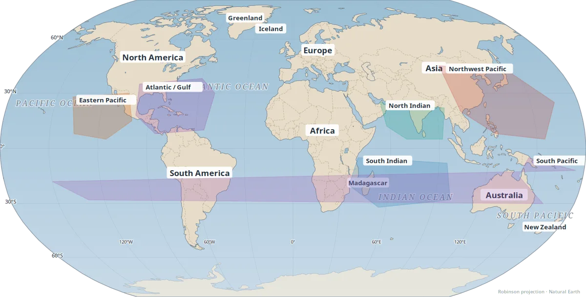
Map key
- Atlantic / Gulf
- Eastern Pacific
- Northwest Pacific (typhoons)
- North Indian
- South Indian
- South Pacific
Basin shading shows typical formation regions; individual storm tracks vary.